Tervetuloa tarkastelemaan Häme by Cycle pyörävaellusreitistön reittiluonnosta reitin osalta Riihimäki-Forssa-Hämeenlinna. Tämän sivuston osoite on lähetetty vain reitin varrella oleville tiekunnille tai kiinteistönomistajille.
Tarkastele reittiä lähemmin omalta alueeltasi alla olevasta linkistä. Linkki vie sinut Outdooractive karttapalvelun verkkosivulle, johon reittiluonnos avautuu.
Näin käytät karttaa tietokoneella:
- Avaa reitti: Klikkaa karttaa, niin näet sen tarkemmin.
- Lähennä tai loitonna karttaa: Käytä hiiren rullaa liikuttaaksesi näkymää lähemmäs tai kauemmas.
- Siirrä karttaa: Pidä hiiren vasen nappi painettuna ja vedä karttaa haluamaasi suuntaan.
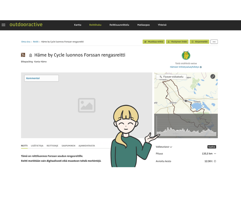
Näin käytät karttaa puhelimella:
- Avaa reitti: Klikkaa karttaa reitin tietojen alta, niin näet sen tarkemmin. Huomaa, että kartan latautumisessa saattaa mennä pieni hetki.
- Lähennä karttaa: Laita kaksi sormea ruudulle ja liu’uta niitä erilleen.
- Siirrä karttaa: Kosketa karttaa ja vedä sitä haluamaasi suuntaan.

Linkki Outdooractive karttapalveluun:
Lue lisää Häme by Cycle hankkeesta Hämeen virkistysalueyhdistyksen verkkosivuilta.
Route information letter in English
A Digitally Guided Bikepacking Route to be Established in Kanta-Häme
Dear Representative of a Private Road Maintenance Association, Road Shareholder, or Landowner,
Häme Nature Recreation Association and LAB University of Applied Sciences, in collaboration with the Finnish Center for Bicycle Tourism, have designed digitally guided bikepacking routes for the Kanta-Häme region as part of the Häme by Cycle project, funded by the Rural Development Fund. The planning process has involved consultation with all municipalities along the route, including the cities of Hämeenlinna, Forssa, and Riihimäki, as well as the municipalities of Tammela, Jokioinen, Humppila, Hattula, Loppi, Hausjärvi, and Janakkala. These municipalities support the implementation of the route.
What is Bikepacking?
Bikepacking is a form of bicycle touring that takes place on gravel roads, forest roads, and easy trails, similar to hiking but with a bicycle. These trips can last from a few days to several weeks. Since bikepacking primarily follows existing roads, it differs from mountain biking trails and is not considered off-road cycling in the traditional sense.
Key Information about the Häme by Cycle Route
We are contacting you to inform you about the launch of a digitally guided bikepacking route network, which spans approximately 650 kilometers in total. One of the planned route sections passes through your property or along a private road where you are a representative or shareholder of a road maintenance association. The use of individual trails along the route will be separately agreed upon with the respective landowners.
Attached to this letter, you will find an overview of the entire route, along with a link to Häme Nature Recreation Association’s map service, where you can view the route alignment in more detail.
Digitally Guided Route
The route will not have physical waymarking, nor will any construction, maintenance, or repair work be carried out on the route unless specifically agreed upon with the road maintenance association, road shareholders, or landowners. The municipalities along the route are responsible for the route, and they have outsourced the maintenance of the digital route information to Häme Nature Recreation Association.
This route is planned to be published in a digital map service in the spring of 2025. Bikepackers will navigate the route using a smartphone or a separate GPS device, relying on Finland’s “Everyman’s Rights” (Jokaisenoikeus). The route descriptions will guide cyclists to use services along the route as well as designated rest and camping areas.
The route has been designed to minimize any disturbance or inconvenience to landowners and road shareholders, ensuring that it does not interfere with existing land use. The route primarily follows public roads, private roads, forest roads, and existing hiking trails, with some additional trail sections. No construction, repair, or maintenance work is required for the route.
No New Responsibilities or Obligations
The publication of the route does not impose any new responsibilities or obligations on road maintenance associations, road shareholders, or landowners. The municipalities responsible for the route will oversee the digital guidance for users.
However, if road maintenance associations, shareholders, or landowners wish, they may inform the route administrators of any land use changes or maintenance work that could be relevant for route users. This information can then be reflected in the digital guidance system.
Promoting Responsible Outdoor Activities
A general overview of the digitally guided bikepacking route is provided below. A detailed route draft can be viewed at: https://hvay.fi/reittiluonnos-1/ or via the adjacent QR code in the letter.
The route descriptions encourage bikepackers to use services along the route and official rest and camping areas. The route alignment has been planned to ensure that it does not cause disruptions to landowners.
Additionally, the route descriptions emphasize the importance of following Metsähallitus’ Outdoor Etiquette and Suomen Latu’s Mountain Biking Guidelines.
We kindly ask you to contact us by March 18, 2025, if you have any questions about the route or wish to suggest an alternative alignment. Since digital navigation allows for flexible adjustments, you are also welcome to contact us in the future regarding any changes related to the route.
Property ID affected by this notice:
Best regards,
Kirsi Roos
Coordinator
Häme Nature Recreation Association,
Häme by Cycle Project
📧 kirsi.roos@hvay.fi
📞 050 366 1210